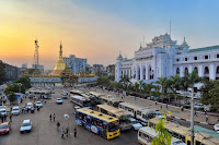
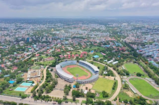
Yangon city
Yangon is the former capital of Myanmar and the capital of Yangon Division. Although the junta officially renamed Naypyidaw as the capital in March 2006, [2] Rangoon, with a population of over 7 million, remains Burma's largest city and most important commercial hub.
It is also the largest port city in Myanmar. It is located at the intersection of 16 ° 46'N and 96 ° 10'E. Yangon River (also known as Hlaing River) and Pazundaung River; Located at the confluence of the Pegu River, seagoing vessels can actually enter and leave the safe port of Yangon. Yangon is only 21 miles from the estuary. With local backbone areas; Waterway It is connected by air. As a gateway, it became a center of commerce.
Yangon (588 BC) dates back more than 2,600 years to the history of the Buddha's hair, but has remained a pilgrimage site. [5]
Alaung Min Dharma, founded by the Konbaung dynasty in 1755, conquered Dagon and renamed it "Yangon" and settled around Dagon.
The British East India Company built the plant in the 1790s. [8] In 1823 it had a population of 30,000. [9]
During the First Anglo-Burmese War (1824-26) during the reign of Bagyidaw, the seventh king of the Konbaung dynasty, the British successfully occupied Rangoon. After the war, Rangoon was ceded to the Burmese under the Treaty of Rangoon. In 1841, during the reign of Burmese King Thayawaddy, Rangoon was engulfed in fire.
Colonial Yangon (1852 to 1948) amended
The British occupied all of Rangoon and Lower Burma during the Second Anglo-Burmese War of 1852. At the time, Yangon was a small fishing village centered on the Shwedagon Pagoda.
Later, Rangoon was transformed into an economic and political center of British Burma. Based on the design of Alexander Fraser, a military engineer, the British undertook the Greek project to build a shrimp pond in the eastern part of the delta; To the west, the Yangon River was demarcated and a new capital was built. In 1878, the British established Yangon College (now Yangon University) under the auspices of the University of Calcutta in British India.
D
Secretariat (1910)
After the British occupied Upper Burma in the Third Anglo-Burmese War in 1885, Rangoon became the capital of all British Burma. In the 1890s, Rangoon's growing population and trade gave birth to affluent settlements in the northern suburbs of Royal Lake (now Kandawgyi) and Inya Lake. The British also built hospitals and colleges, including the Yangon General Hospital. Colonial-era Yangon is known for its vast parks and gardens. Lakes; It became known as the "Garden City of the Orient" with its mix of modern buildings and traditional wooden architecture. In the early 20th century, Rangoon had the same public services and infrastructure as London in London.
Before World War II About 55% of Rangoon's 500,000 population is Indian or South Asian, and about a third are Burmese, Karen တရုတ်၊ Anglo-Burmese and other ethnic groups. After World War I Rangoon became the center of the far-left Burmese independence movement led by Rangoon University students. 1920 There were three nationwide protests against the British government in 1936 and 1938. Yangon (1942)
It fell to the Japanese in 1945 and suffered major damage during World War II. 1948 On 4 January, after the country regained its independence from the British Empire, Rangoon became the capital of the Union of Myanmar.
Renovated from present Yangon (1948 to present)
After the independence of Burma in 1948, Roads named after the colonies; Parks have been changed to more nationalist Burmese names. In 1989, the coup government changed the English name of the capital to "Yangon" and changed other English names to Burmese. (Most Burmese, who thought the junta should not do this, did not accept the change, and many of its publishers, including the BBC, and foreign countries, including the UK and the United Kingdom, did not.)
D
Mahabandula Bridge in the center of the city
Rangoon has been expanding since independence. Successive governments in the 1950s North Okkalapa and South Okkalapa townships; In the 1980s, Hlaing Thar Yar; Shwepyithar and South Dagon townships were expanded. Today, Yangon covers an area of about 600 square kilometers.
During General Ne Win's rule of non-interference in the affairs of other countries (1962-1988); Yangon's infrastructure is poorly maintained; The damage was caused by the inability to keep up with the growing population. In the 1990s, the junta's more open market policies made it more attractive to domestic and foreign investment. The city's infrastructure has also brought a fair amount of modernity. Residents of the interior of the capital were also forcibly relocated to expanded cities. Many colonial-era buildings were also destroyed. High-rise hotels; Office buildings; By providing space for stalls, city officials have also added about 200 prominent colonial-era buildings to the city's heritage list. Major construction plans have resulted in the construction of six new bridges and five new roads connecting the capital and the industrial estates. Still, many parts of Rangoon lack basic infrastructure services such as 24-hour electricity and regular garbage collection.
After independence, Rangoon became more ethnically ethnic Burmans. After independence, many South Asians and Anglo-Burmese left. During the 1960s, General Ne Win's government put pressure on foreigners, forcing many South Asians to leave. However, large numbers of South Asians and ethnic Chinese remain in Rangoon. Anglo-Burmese plaques have disappeared significantly due to exodus or intermarriage with other Burmese groups.
Yangon was established in 1974. Opposition to the government in 1988 and 2007; It was the center of protests. Every time the government opened fire on protesters, bloodshed was seen on the streets of the capital. In May 2008, Cyclone Nargis hit Rangoon. There were few casualties in the capital, and three-quarters of Rangoon's industrial infrastructure was destroyed. An estimated $ 800 million was lost.
2005 In November, the junta designated Naypyidaw, 200 miles (322 km) north of Rangoon, as its new administrative capital. At the same time, many government departments were relocated to the newly built capital. Nevertheless, Yangon remains Myanmar's largest city and most important economic hub.


Comments
Post a Comment